Wednesday, March 24, 2010

Interoperable Communication as crucial emergency response tool

Georgia new interoperable communication system (Courtesy: Georgia Tech Research News)

Finally I took the time to conclude this post about one of the pillars of emergency management, interoperable communication.
Interoperability is a property referring to the ability of diverse systems and organizations to work together (inter-operate). The key aspect of the emergency response mechanism is the capability to bring together different responders and their apparatuses in order to work in a coordinated manner on the same platform or different communicating platforms.
In this post I want to debate around the importance of the interoperable communication as one of the emergency management milestones.
Interoperability is an important issue for law enforcement, fire fighting, EMS, and other public health and safety departments, because first responders need to be able to communicate during emergencies. Traditionally, agencies could not exchange information because they operated widely disparate hardware and radio apparatuses that were incompatible. Even the advanced agencies' information systems such as computer-aided dispatch systems (CAD) and records management systems (RMS) functioned largely in isolation, so-called "information islands." Agencies tried to bridge this isolation with inefficient, stop-gap methods while large agencies began implementing limited interoperable systems. These approaches were inadequate and the nation's lack of interoperability in the public safety realm become evident during the 9/11 attacks on the Pentagon and World Trade Center structures. Further evidence of a lack of interoperability surfaced when agencies tackled the aftermath of the Hurricane Katrina disaster.
To reach interoperability agencies should dialog on same platform-based systems. First responders have complex needs for specialized equipment and personnel and communications infrastructure is one of several critical priorities. The U.S. Department of Homeland Security’s Federal Emergency Management Agency
(FEMA) assists first responders through the Commercial Equipment Direct Assistance
Program (CEDAP). Since 2005, CEDAP has provided $69.7 million in equipment and
Equipment training to law enforcement agencies, fire, and other emergency responders.
But structure is not all. Procedures and a tired approach to communication must be shared and agree upon. Communication plans at both horizontal (among agencies/operators on the ground) and vertical level (from local to regional to national) should be designed.
Other important concept related to successful interoperable communication is redundancy.
Communication means must be multiple, of different nature and connected with different networks as well as promptly available. Such approach is considered vital when the environmental conditions created by the emergency related event are such that the most common means could be out of service (land line, cellular phone, emails, etc). I remember that when I was working with the UN, every mobile unit to be compliant with the Minimum Operating Standard Security (MOSS) needed to avail the following systems: Cellular phone, satellite phone, VHF/UHF radio, HF radio. Other redundant communication means are Voice over IP, emails, land line, amateur radio etc.
Such redundant system has to be maintained operational and regular drills should be conducted to test them as well as the capability of the operators to handle them. I recall during the conduction of Risk Security Assessment, the most common problems were the most (apparently) simple once too: batteries not charged, chargers not available, missing sim cards (for sat phones), operators scarce knowledge of use of radio apparatuses as well as call signs and communication procedures, etc.
Drills are absolutely important to keep the network maintained and operators refreshed.
The impression I have is that emergency entities have accomplished great results in these recent years on the path of interoperability but a lot yet remain to be done. Just to mention one example: Hurricane Katrina (2005) death toll: 1836, Hurricane Gustav (2008) death toll: 0. Both hurricanes hit same area. I don’t want to speculate on the causes of failure and success of the mentioned rescue operations but it’s evident that interoperable communications played a key role in 2008. Analysis of responses to hurricanes and whether related catastrophic events could be interesting topics for future posts.


Hurricane Gustav - Satellite photo (Courtesy: philantromedia.org)

Tuesday, March 2, 2010

My role in Emergency and Preparedness

After one month of absence from this blog I finally decided to dedicate this post to my new position.
December 21st 2009, it was my first day as Deputy Director Emergency and Preparedness with New York State, Department of Health. I left the United Nations World Food Programme where I was working as Senior Field Security Officer, specialized in Security Risk Assessments and Risk Management. As you probably know reading my previous articles I have been deployed in several countries in almost all continents (excluding Oceania). I am so thrilled to have embraced this new challenge in New York.
I have finally the chance to enrich my professional expertise through a different emergency perspective/approach compared with the one I was used to while working in developing countries with the UN. As UN planner and risk assessment specialist I had to take into considerations factors like political instability, terrorism, criminality, social/economic insecurity etc, common elements in developing countries. These elements heavily influence the emergency/security/response planning and implementation. The final emergency structure which will emerge will have to provide the proper safety and security features to those humanitarian operators deployed everywhere in the world.
Here in New York the above mentioned factors are almost inexistent so that the planner can dedicate all the available resources and his/her own energies to the core business, the protection of the people, the structures, the assets under his/her responsibility when a disaster hits. The unfortunate sad events of 9/11 and the Hurricane Katrina demonstrated how important are planning, preparedness and training. I have decided to approach the concepts of emergency, safety, security and preparedness commenting real life cases, not related to my job/profession. This way the objectivity and the "right distance" from the events will be preserved in order to provide a unique perpective as my vision of the future of emergency management.

I

Thursday, January 21, 2010

Sri Lanka - August 2009 - Security considerations and mitigating measures

I have been in Sri Lanka the summer of 2009, as Security Manager for a large International Organization. This post is intended to briefly describe the post war situation and analyse the best mitigating measures in order to reduce tensions and stabilize a complicated situation which affects an entire population.
After three decades of a mainly ethnic war that has seen a combination of asymmetrical warfare activities, the Government announced victory over the LTTE - Liberation Tamil Tigers of Elam (some Government officials stated victory over “terrorism”) on 18 May 2009. The latter part of the past two years has seen an intensified conventional war in the Northern part of the country (Wanni) as well as asymmetrical warfare tactics that mainly constituted suicide bombings, assassinations, disappearances, abductions, intimidation the denial of basic human rights such as freedom of movement and freedom of speech (as manifested in the suppression of the national media). The war efforts resulted in large numbers of displaced civilians across the East and the North of which the past six months was probably the most intense. It resulted in massive casualties (dead and injured of which a large percentage is maimed and disabled for life) amongst both the Tamil population in the North and the Government of Sri Lanka (GoSL) security forces. It leaves a Tamil people highly traumatized and a population bitterly divided along the ethnic fault line.
When I was there during the summer 2009, for the 262,000 internally displaced persons IDPs confined to IDP camps in Vavuniya, security risks associated with poor living conditions – in particular insufficient water supply, sanitation and waste disposal were resulting in significant health risks and growing dissatisfaction amongst the displaced community. The capacity of health services to address the needs of both the local and displaced populations was overstretched and added to general security and protection risks. Other protection and security challenges included site congestion, military presence, limited access to justice and family separation. Further, lack of freedom of movement resulted in an almost total dependence on humanitarian assistance and extreme frustration within the IDP community.

Considerations

In the immediate aftermath of the military conflict, it was expected that the Government shifted its focus from the military campaign (which dominated their strategic approach) to a lasting and acceptable political solution. The Tamil population will not accept a position in which they will be dominated by the Sinhala majority and in which they feel that their basic human rights are ignored. It is to be expected that the Government would be reluctant to accept international cooperation to achieve this paramount objective.
The current military victory has brought some level of unsustainable stability. It would have to be strengthened by infrastructural development to stimulate economical growth which, jointly with a political solution, social harmony has a greater probability to succeed.

One of the most significant mitigating measures to counter the breeding of a new resistance would be a high trustworthy reconciliation program by the Government and a transparent/ participative process towards a new political dispensation that would accommodate the Tamil people to their satisfaction. Whether this process will be implemented and how are elements which remain to be seen.


Reinforced concrete SL Army bunker in the proximity of Trincomalee Beach (East Coast)


SL Navy Bunker facing the Mannar Lagoon (West Coast)

Tuesday, January 12, 2010

Ecuador part 2: Crime, Natural Disasters, Road Conditions

Crime:
The highest area of concern is the common crime though the police and the law enforcement agencies are doing their best to reduce it. Good results have been achieved but a lot remain to be done. The most common crimes are petty thefts and robberies usually following and armed aggression. The micro criminality trend in Quito is increasing despite the fact that the government has recently increased the number of police agents on the ground cutting their number from Embassies and International Organizations. The targets are usually those individuals carrying rucksacks, bags or cases. Cellulars and laptops are the most wanted objects by thieves. Cars are targeted as well. Usually victims are not killed if they do not react. The express kidnap is a “specialty” of the locations along the Pacific Ocean coast. Frauds and credit card cloning are two common crimes as well.
During my visit in Ecuador I received an interesting intelligence analysis very detailed and based on updated figures, prepared by the local branch of an international security company.
The threat from common criminal elements is considered HIGH in certain areas; violent crime is a serious and growing Movements after dark should be avoided.
An other element which can trigger social unrest is the widespread xenophobia against Colombians. Ecuador hosts 500.000 displaced Colombians, out of which 50.000 as refugees. This figure will be probably incremented up to 200.000 in the next future. The anti Colombians feeling is invigorated when crimes are organized by them against local populations in Ecuador. Along the border, the presence of Colombian prisoners in the Ecuador prisons reaches 90%.

Organized crime:
The organized crime in Ecuador is often strictly connected with drug related activities. Such international organizations are composed by Ecuadorian, Colombia and Peruan and are active in the northern areas of Carchi, Sucumbíos and Esmeraldas. These regions face infiltrations of Colombia guerrilla elements such as FARC, Aguilas Negras, etc. as well as narco traffickers. Ecuador is used by guerrilla as a place where fighters can rest since the Ecuadorian Army counter guerrilla activities are never as efficient as the Colombian ones. The guerilla presence in the northern regions of Ecuador has hugely affected the local economies. Guerilla fighters can pay cash for their accommodations, services, needs thus creating an economy fully dependent from their presence. Furthermore, part of the enormous quantity of drugs product in Colombia and Peru’ is transported via trucks towards the Ecuadorian coast in order to be shipped.
UNDSS country advisor is concerned that WFP vehicles could be used by narco traffickers hiding among the food packages some drugs. There is no evidence so far but it could be considered as potential threat. To figure it out about how big this phenomenon is, one should look at the quantity of cocaine confiscated by the Ecuadorian law enforcement agencies annually, about 30 tons.
A large number of Ecuadorian peasants live in the areas nearby the Colombian border and cross the border every day or spend a period in Colombia to cultivate coca plantations. They are skilled and relatively well paid compared with the salary earned in the mother country. Along with this group of people across the border several illegal or semi legal (tolerated by the authorities) activities take place. Particularly there is a quite large smuggling of gasoline and petroleum, stolen illegally creating holes in local pipelines, cement and sulfuric acid. These elements are vital for the drug laboratories to refine and produce cocaine. Milk is sold to those working in the laboratories in order to reduce the intoxication produced during the refining process, while inhaling intoxicating vapors. Indeed, several towns and villages rely completely on commerce, smuggling and logistic activities to support guerrilla. The gas cylinder is sold illegally in Colombia at 10 times more its price in Ecuador, which by the way has a subsidized price.

Several professional killers, Colombian and Ecuadorian, are always available to offer their services to those involved in narco activities.
A high number of arms and weapons are smuggled as well across the border.
As stressed, in Ecuador operate international criminal organizations composed by Colombian, Ecuadorian and Peruan. The FARC also improved its ties with local indigenous populations helping the drug traffic.
Young tourists are often involved in transportation of drug in their rucksacks or suitcases.
Money laundry is the most evident fact about the dependence of this region on illicit activities. New and shining luxury buildings are built in the Lago Agrio surroundings and other northern localities.
It must be said, finally, that large families are widespread in villages across the border both in the Ecuadorian and Colombian sides.

Natural Disasters:
The Earthquakes and tremors are the most concerning natural disasters in Ecuador. The last deadly one, actually two strong earthquakes with magnitude 6.1 and 6.9 affected Ecuador, March 5th 1986. It created a serious socioeconomic problem for the country and triggered hundreds of associated geologic hazards—massive landslides, subsidence, liquefaction, impoundment of rivers, and other effects common to earthquakes that have occurred in similar settings. In spite of the seriousness of this structural damage, the economic and social losses directly due to earthquake shaking were small compared with the effects of catastrophic earthquake-triggered mass wasting and flooding in the area adjacent to Reventador Volcano. Rock and earth slides, debris avalanches, and debris and mud flows E of the Andes resulted in the destruction or local severing of nearly 70 km of the Trans-Ecuadorian oil pipeline and the only highway from Quito to Ecuador's eastern rain forests and oil fields.
Another natural threat is provoked by the presence of the Volcano Guagua Pichincha whose capital Quito wraps around its eastern slopes. In October of 1999, the volcano erupted and covered the city with several inches of ash. It threats the city indirectly since its principal crater is opened towards west. Other two volcanoes are active in Ecuador: Reventador and Cotopaxi.
The landslides affect the generally country during heavy showers mainly along the highway connecting Quito and the Pacific coasts which can be affected by flooding as well.
The risk posed to WFP by natural disasters can be assessed as medium.

Red Cross volunteers, assist victims of natural disasters in Ecuador (courtesy Dipnote)

Road Conditions:
Traffic is generally chaotic in Ecuador. There is a low respect for the transit rules as well as for traffic local police.
Some cases of police corruption related with car incidents have been reported.
The phenomenon seems to be increasing after the introduction of a new stricter traffic law enforcement rule. According with it police can now arrest preliminarily a driver involved in an incident and the car be confiscated. To avoid such rigid measures some policemen can be available to “adjust” their report.
The lack of trust in the police is generally associated with their lack of action and investigation results.
The justice system appears to be corrupted too increasing consequently the level of impunity.
In Ecuador, the risk of a fatal accident appears to be medium. The hazard presented by road travel is assessed as high.

MEDICAL CARE AVAILABLE AND CASEVAC PLAN
Medical care facilities are widespread in Ecuador. Adequate medical and dental care can be readily obtained in the major cities of Ecuador. In smaller communities services are limited, and the quality is variable. Ambulances, with or without trained emergency staff, are in critically short supply. Serious cases must be evacuated to the Ecuadorian mainland for treatment.

Wednesday, December 30, 2009

Ecuador. Beautiful country facing different degrees of insecurity.

I visited Quito, Ecuador between March and April 2009 during a Security Risk Assessment mission. I had to evaluate type and dimension of threats, the vulnerabilities of the Organization I was working for (weaknesses and strengths) and finally assess their programme characteristics and priorities. In this post I am going to describe briefly the Country form a different point of view focusing on levels of security applied to different regions. In a second post I will treat the details of threats posed by common crime, organized crime, terrorism, natural disasters, road conditions and casevac/medevac. Obviously my posts, as discussed at the very beginning of my blog, do not contain confidential information of any kind and reflect my own view of the security situation in the country.
They want to present a different approach to countries which focuses mainly on security and safety.
Ecuador is the smallest of the Andean countries. It has the highest average population density in South America and the highest percentage of Native Americans. It is one of the two South American countries (with Chile) that have no border with Brazil. As its name indicates, Ecuador extends over both sides of the equator line. It is bordered in the North by Colombia (700 km) and in the East and South by Peru (1420 km border), in the West by the Pacific Ocean (2,237 km of coastline.)
Being on the equator gives the country its peculiar weather conditions, it also allows it to have 12 hour day year round.
Ecuador has three main geographic regions, plus an insular region in the Pacific Ocean, which is the first element of heterogeneity:
La Costa, or the coast, comprises the low-lying land in the western part of the country, including the Pacific coastline.
La Sierra ("the highlands") is the high-altitude double belt running north-south along the center of the country. Between the double range of the Andes, there is a high altitude (2000-3000 meters) basin, which includes main old Ecuadorean cities (from north to south: Tulcán, Ibarra, Quito, Latacunga, Ambato, Riobamba, Cuenca, Loja.
La Amazonía, also known as El Oriente ("the east"), comprises the Amazon rainforest areas in the eastern part of the country, accounting for just under half of the country's total surface area, though populated by less than 5% of the population.
The Región Insular is the region comprising the Galápagos Islands, also on the Ecuador line, some 1,000 kilometers west of the mainland in the Pacific Ocean.

Security Phase/Security Level (at time of my visit):
In Ecuador four different security phases have been activated in different areas of the country. I am going to use a system based on letters, from A (lower level) up to F (higher level of insecurity). The level system used (created by me) here has the only purpose of showing the different degrees of security within the different regions of the country and is described as follow:

Northern Border with Colombia:

Level D:
1. Following towns belonging to Province of Sucumbíos in the Northern Border with Colombia are under level D: Palma Roja, Santa Elena, Puerto Rodríguez, Santa Rosa, General Farfán, Dureno y Pacayacú.
2. Following towns belonging to district of San Lorenzo (Province of Esmeraldas) in the Northern Border with Colombia are under phase 3: Palma Real, Ancón, Mataje, Tambillo y Pampanga.
3. All the rivers in the Northern Border with Colombia are also under level D.

Level C:
Province of Sucumbíos, with the exception of the towns mentioned in point 1, above, which are under Level D.

Level B:
1. The Province of Carchi, with the exception of the rivers in the Northern Border, is under level B.
2. City of Esmeraldas and district of Eloy Alfaro in the province of Esmeraldas are also under level B.
Volcanic activity of Tungurahua:
Province of Tungurahua:
1. The towns of Pondoa and Juive Grande, belonging to the district of Baños are under level B.


2. The towns of Cusúa and Chacanco, belonging to the district of Pelileo are also under level B.

Province of Chimborazo:
1. The towns of Bilbao, Paligtagua, Yuibug, Clocontus, belonging to the district of Penipe are under level B.
2. The towns of Cahuají, Cuso, Chazo and La Palestina, belonging to the district of Guano are also under level B.
When visiting these areas, it is recommended to get fresh informations about the actual security situation.
Level A:
The rest of the country including the capital Quito.

SECURITY SITUATION – THREAT ANALYSIS
Safety and Security – overview:
With the signing of the Peace Agreements with Peru in 1998, Ecuador overcame one of the biggest obstacles in the formulation and execution of its foreign policy since its birth as an independent Republic.
After a Colombian forces attack against an illegal guerilla camp on the Ecuadorean side of the common border, Quito severed diplomatic relations with Bogota. The tension is a political one between the two governments, since populations on both sides of the border are mixed and maintain a long tradition of brotherhood, even against their respective capitals (especially for their complicity in a large range of smuggling activities.) Nevertheless, the Ecuadorean stance is to fight against all raid or attack in its territory, either from legal or illegal forces. For that purpose, the government is reinforcing (at high cost) its military and police presence in the northern area, affecting illegal activities (of the majority of the population), but trying also to bring development with the “Plan Ecuador”, designed for peace and social and economic growth, in contrast with “Plan Colombia” (designed against illegal groups and activities.)
Ten years after establishing peace in the south, the concern is now in the north.
The diplomatic relation with Colombia was broken two days after the Colombian military attack on a guerilla camp on March 1st, 2008 in Ecuador, in which the second most important FARC commander was killed.
That event has even more urged a new Ecuadorian defense policy which included a reinforcement of the northern border area (around 8,000 soldiers) and an effort to modernize equipments.
As mentioned, Ecuador faces several security challenges listed as follow, in decreasing order:
road traffic accidents, criminality, street robbery, street assault, house break-in, office break-in, office occupation, vehicle break-in, earthquake, volcanic activity, floods, landslides, domestic violence, rape, fraud, counterfeit money, car theft, street or road blockade, kidnapping, hostage taking.


Riot Ecuadorean Police escorting a public gathering in the centre of Quito.


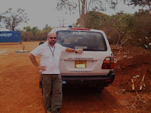
Author during the SRA in Ecuador.

Thursday, December 3, 2009

Ayacucho - Peru. Travelling in harsh terrain conditions

The town of Ayacucho is located in the south-central Andes of the country.
It lies in quiet and calm area since Shining Path terrorist movement based once here had been defeated by Governamental forces in the eighties. In fact, Ayacucho was one of the most important strongholds of Shining Path in the past. The threat of a potential terrorist activity is low but precautions must be taken during travel missions. Traveling by road especially at night is dangerous. The areas potentially at risk are the Provinces of La Mar and Huanta. Overland travel from Ayacucho to San Francisco is not recommended.
The area has experienced some assaults by local criminal gangs of youngsters who usually prefer to operate during night time or early in the morning. The methodology used to attack buses and cars is well known: one of the members of the gang lies down in the street pretending that he had an accident so that the bus stops and get assaulted. In the meantime the local criminals rob the passengers of their belongings. The level of threat related to common criminality in the Ayacucho surroundings, is medium.
The office I visited in town during my RSA is located in an area called Huamanga which enjoys a low level of criminality.
The threat posed by earthquakes and water floods is very low in this area.
The local roads connecting Ayacucho and the neighboring rural communities, which are regularly used by local populations, are not paved and very dangerous. There are no side road protections and roads are often narrow. Several bends make the driving even more challenging. If a vehicle is coming the other way, our vehicle must stop trying to maneuver using the little road side space if present.

Ayachucho surroundings: local community involved in an UN funded agricoltural project (food for work)


In the rural areas the road conditions are even poorer than in town. Most of the local roads are not paved and in some instances operations are cancelled if weather conditions render part of the routes too dangerous for travel. There is high risk of car accidents though the number of cars circulating is scarce. The accident could be generated by landslides, or softness of terrain, as well as an impact with another car. If a mechanic problem takes place, (my recommendation) the driver must stay with the car while the passenger looks for help. The environment can be dangerous due to harsh natural conditions of the terrain and the lack of radio coverage in the Ayacucho Region. There is a high risk to be assaulted during night hours. There is no cellular network up in the mountains as well so that the only communication means is the Sat phone. The risk of an accident by road travel is assessed as high.


Author while travelling between Ayacucho and Huancavelica at around 4700 mt. above sea level, sorrounded by glaciers.

Sunday, November 29, 2009

PERU: General security situation, considerations from my Risk Security Assessment

I visited Peru in February and March 2007 while conducting a Risk Security Assessment mission. The materials used to prepare this blog post have been updated and carefully reviewed in order to provide an idea about the actual security context in Peru.

SITUATION:
Peru is suffering from an increase in crime from simple muggings through to violent kidnapping; mostly confined to urban areas and within the poorer districts during the day but widespread after dark. The current government is slowly becoming increasingly popular, despite of the economic situation declining and local crime rising. Regarding the terrorism groups who used to frighten Peru, Shining Path and Tupac Amaru, both have been almost successfully fought in the Eighties and right now some old militants are trying to reorganize themselves. Those trends are channeling themselves towards the big drug traffic ants as the military-like expertise they can offer is very useful to protect illegal cocaine laboratories and the transportation of the final product. It has to be borne in mind that Peru is the second largest coca producer in South America, after Colombia. Urban driving conditions are appalling and at present they are assessed of being probably the greatest threat to staff in Peru. One of the most common security challenges to personal security is related to the use of taxis. There are almost no road regulations and police is literally not “visible” on the streets. Often illegal taxi drivers put on their car a Taxi sign. It has been reported that a massive quantity of false circulation documents as well as driving permits are fake and easy to obtain, since there is a flourishing market for false documents in Lima.
Furthermore, driving schools often “sell” driving license without performing any practical exams or oral/written tests.
Kidnapping can be considered a high risk factor in Peru, above all for foreigners travelling in Peru.
Often the victim is forced to withdraw money from ATM machines, usually before and after midnight so that the cash amount is double as it refers to two days. The phenomenon is popularly called Millionaire Walking (Paseo Milionario). It is recommended to use secure taxi company before arriving in country. Local staff is required to attend to a specialized security awareness training in addition to the basic security training. This is primarily due to deal with the threat of kidnapping and being involved in a car accident in very remote areas with no communication and close medical facilities.

SECURITY SITUATION - THREAT ANALYSIS
President Alan Garcia is at his second mandate as president of Peru. People are slowly but steadily increasing their support of his administration since he is giving clear signs that he wants to do something concrete to help the poor conditions of his country. For example, he is the author of a law which will ask the major mine companies to pay a “volunteer contribute” (several million of dollars) to organizations involved in fighting hunger in Peru since the State program organizations waist up to 40% of the available resources. If those political actions will help Peru to improve or if this will be a barely cosmetic political move it is not clear.
There are still concerns over renewed insurgency activity from the Shining Path (SL) guerrilla group having them join the drug traffickers with their support in security.
Peru is the second largest producer of cocaine in South America after Colombia. Here coca plantations are not illegal, but coca farmers must accept to sell part of the production to a State owned company. The quantity to be sold is minimal so that the great majority of it is then illegally purchased by drug dealers. The system does not help the fight against drug smugglers as the cultivations are not illegal and it is very difficult to define the line between legality and illegality.
The areas of biggest concern are, however, the common criminality and road accidents. Common criminality is widespread in the country with a peak level in the periphery of Lima. Law enforcement agents are not visible, and according to the official data, are not doing enough to fight this phenomenon. The second area of concern is related to car traffic and accidents. As said, there is a high risk of becoming a victim of a car accident, since there is little order and respect of road regulations. In Peru public transportation managed by government or local authorities does not exist, but it has been left to private companies and individuals. There is little control on authorizations and documents so that virtually anybody who owns a car or a minibus can be a taxi or public bus driver. Furthermore, a long time passes between vehicle technical inspections increasing the risk of mechanical breakdowns and incidents due to the lack of maintenance. The parliament has recently approved a law which forbids the importation of used cars older than five years. The high taxes to buy a new vehicle (50% of the price) have created a stagnant situation which do not facilitate the replacement of older models.


Author posing with a local community involved in an agriculture based project in the Handahuaylas area.

Peru has a working relationship with Brazil, although this has been strained by US aid packages to Lima. However, Peru is a member of MERCOSOR trade region, which is dominated by Brazil, bringing the countries closer together. Bolivia is a close partner, largely due to mutual concerns over Chile. Whilst Peru and Chile have been historic rivals, the current relationship is reasonably amicable, although the dispute over maritime borders is still alive. The two countries are working together on border security and anti-terrorist operations. Border disputes with Ecuador remain a source of tension, although outright combat seems unlikely.
The once special relationship with Japan has been strained, following the flight of Garcia predecessor, Alberto Fujimori, to Japan in 2000 and the associated international pressure on Japan to extradite him for murder. Fujimori undergone a trial, has been accused of several imputations and is now in prison. His daughter Keiko, actual Peruvian politician, is planning to run for President of Peru in 2011. How this element could change the feeling of the Peruvians about a possible return of the former President remains to be seen.
Peru’s relationship with the US has had a rocky past but is now close, particularly with large US funding for narcotics and security operations. However, many in Peru are critical of the US for failing to address fundamental trade and social problems within the country through their funding packages. There appears to be some credible information that international terrorists are present in the country but it is not known to which organization they belong; their activities seem to be linked with drugs, financing and false documentation.
The wave of internal terrorism, which Peru suffered in the 1980s and 1990s, has largely passed, but it has not completely disappeared. Remnants of the Shining Path (SP) movement (estimated at around 300 fighters and an unknown number of political activists) are still active in the Apurimac, Ene and Lower Huallaga Valleys. SP was responsible for the US embassy bombing in 2002. A group of terrorists also abducted gas pipeline workers near Toccate in the Ayacucho Department on 9th June 2003. In addition, the Garcia government, despite of his increasing popularity, remains disliked on basic reforms, which gives the potential for protests and strikes if the economic and social situation worsens. There have been recent protests by coca farmers over crop eradication by US-funded anti-narcotics operations and there are signs that the farmers are becoming increasingly militant in their opposition to the government’s support for US actions. In fact the project of restructuring coca plantations with other cultivations has given low results in terms of production and prices. The United Nations are also seen as a threat by the coca farmers and the SP who have an interest in coca production being the major security provider.
Off road trip on the Andean Mountains to Huancavelica.