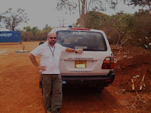
 I visited Quito, Ecuador between March and April 2009 during a Security Risk Assessment mission. I had to evaluate type and dimension of threats, the vulnerabilities of the Organization I was working for (weaknesses and strengths) and finally assess their programme characteristics and priorities. In this post I am going to describe briefly the Country form a different point of view focusing on levels of security applied to different regions. In a second post I will treat the details of threats posed by common crime, organized crime, terrorism, natural disasters, road conditions and casevac/medevac. Obviously my posts, as discussed at the very beginning of my blog, do not contain confidential information of any kind and reflect my own view of the security situation in the country.
They want to present a different approach to countries which focuses mainly on security and safety.
Ecuador is the smallest of the Andean countries. It has the highest average population density in South America and the highest percentage of Native Americans. It is one of the two South American countries (with Chile) that have no border with Brazil. As its name indicates, Ecuador extends over both sides of the equator line. It is bordered in the North by Colombia (700 km) and in the East and South by Peru (1420 km border), in the West by the Pacific Ocean (2,237 km of coastline.)
Being on the equator gives the country its peculiar weather conditions, it also allows it to have 12 hour day year round.
Ecuador has three main geographic regions, plus an insular region in the Pacific Ocean, which is the first element of heterogeneity:
La Costa, or the coast, comprises the low-lying land in the western part of the country, including the Pacific coastline.
La Sierra ("the highlands") is the high-altitude double belt running north-south along the center of the country. Between the double range of the Andes, there is a high altitude (2000-3000 meters) basin, which includes main old Ecuadorean cities (from north to south: Tulcán, Ibarra, Quito, Latacunga, Ambato, Riobamba, Cuenca, Loja.
La Amazonía, also known as El Oriente ("the east"), comprises the Amazon rainforest areas in the eastern part of the country, accounting for just under half of the country's total surface area, though populated by less than 5% of the population.
The Región Insular is the region comprising the Galápagos Islands, also on the Ecuador line, some 1,000 kilometers west of the mainland in the Pacific Ocean.
Security Phase/Security Level (at time of my visit):
In Ecuador four different security phases have been activated in different areas of the country. I am going to use a system based on letters, from A (lower level) up to F (higher level of insecurity). The level system used (created by me) here has the only purpose of showing the different degrees of security within the different regions of the country and is described as follow:
Northern Border with Colombia:
Level D:
1. Following towns belonging to Province of Sucumbíos in the Northern Border with Colombia are under level D: Palma Roja, Santa Elena, Puerto Rodríguez, Santa Rosa, General Farfán, Dureno y Pacayacú.
2. Following towns belonging to district of San Lorenzo (Province of Esmeraldas) in the Northern Border with Colombia are under phase 3: Palma Real, Ancón, Mataje, Tambillo y Pampanga.
3. All the rivers in the Northern Border with Colombia are also under level D.
Level C:
Province of Sucumbíos, with the exception of the towns mentioned in point 1, above, which are under Level D.
Level B:
1. The Province of Carchi, with the exception of the rivers in the Northern Border, is under level B.
2. City of Esmeraldas and district of Eloy Alfaro in the province of Esmeraldas are also under level B.
 Volcanic activity of Tungurahua:
Province of Tungurahua:
1. The towns of Pondoa and Juive Grande, belonging to the district of Baños are under level B.
2. The towns of Cusúa and Chacanco, belonging to the district of Pelileo are also under level B.
Province of Chimborazo:
1. The towns of Bilbao, Paligtagua, Yuibug, Clocontus, belonging to the district of Penipe are under level B.
2. The towns of Cahuají, Cuso, Chazo and La Palestina, belonging to the district of Guano are also under level B.
When visiting these areas, it is recommended to get fresh informations about the actual security situation.
Level A:
The rest of the country including the capital Quito.
SECURITY SITUATION – THREAT ANALYSIS
Safety and Security – overview:
With the signing of the Peace Agreements with Peru in 1998, Ecuador overcame one of the biggest obstacles in the formulation and execution of its foreign policy since its birth as an independent Republic.
After a Colombian forces attack against an illegal guerilla camp on the Ecuadorean side of the common border, Quito severed diplomatic relations with Bogota. The tension is a political one between the two governments, since populations on both sides of the border are mixed and maintain a long tradition of brotherhood, even against their respective capitals (especially for their complicity in a large range of smuggling activities.) Nevertheless, the Ecuadorean stance is to fight against all raid or attack in its territory, either from legal or illegal forces. For that purpose, the government is reinforcing (at high cost) its military and police presence in the northern area, affecting illegal activities (of the majority of the population), but trying also to bring development with the “Plan Ecuador”, designed for peace and social and economic growth, in contrast with “Plan Colombia” (designed against illegal groups and activities.)
Ten years after establishing peace in the south, the concern is now in the north.
The diplomatic relation with Colombia was broken two days after the Colombian military attack on a guerilla camp on March 1st, 2008 in Ecuador, in which the second most important FARC commander was killed.
That event has even more urged a new Ecuadorian defense policy which included a reinforcement of the northern border area (around 8,000 soldiers) and an effort to modernize equipments.
As mentioned, Ecuador faces several security challenges listed as follow, in decreasing order:
road traffic accidents, criminality, street robbery, street assault, house break-in, office break-in, office occupation, vehicle break-in, earthquake, volcanic activity, floods, landslides, domestic violence, rape, fraud, counterfeit money, car theft, street or road blockade, kidnapping, hostage taking.
Author during the SRA in Ecuador.


